City of West Fargo
Street Closures
Current and upcoming street-closure notices from the city.
View street closuresCheck this page before heading to the range because road work may affect your route.
Last updated Friday, July 10, 2026
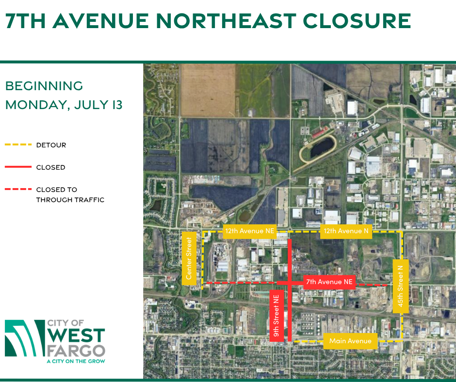
The City of West Fargo says the eastbound lane on 7th Ave NE, between 13th St NE and 7th St NE, will close for contractor work beginning Monday, July 13. Additional closures on 7th Ave NE and at the 7th Ave NE / 9th St NE intersection are scheduled to begin Wednesday, July 22..
The City notice does not provide range-specific access instructions for Red River Range. Because traffic control may change as work progresses, check Google Maps, Waze, or the City of West Fargo project page before you leave. Range hours are unchanged unless separately posted.
Use the city map for construction context, then verify your route with live directions before leaving.
Use the Waze live traffic map first, then compare your route against the city and state construction tools.
Use these external sources for live closure and roadway data.
City of West Fargo
Current and upcoming street-closure notices from the city.
View street closuresCity of West Fargo
Project background and corridor details for the reconstruction affecting this area.
View project detailsNorth Dakota DOT
Statewide live travel map with work zones, road conditions, and traffic impacts.
Open ND RoadsThe page above gives you the fastest way to check access without turning this site into a live traffic system.
Step 1
Start with the destination pinned so you are not guessing the final approach.
Step 2
Compare your route against the West Fargo closures page and construction map.
Step 3
If access looks unclear, contact the range before you head out so you do not waste the trip.
Call the range if you want to confirm the best approach before your visit.